Step 1
Click to download trails link shown above onto your smartphone. The file should read “NPSDR Trails.kml.”
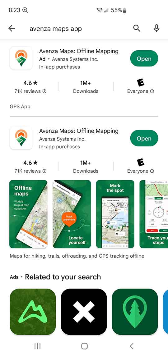
After you have saved this file to your desired location. Install the Avenza Maps App on your smartphone.
Step 2
Tap the “Open” tab and continue to register and “Create a New Account.”
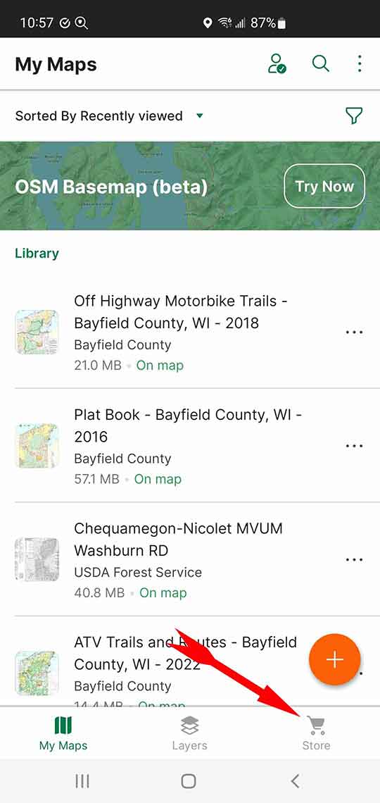
Open the App and look for the Map Library screen and tap on the “Store” icon. Enter “Bayfield County Off Highway" into the search field.
Scroll down to locate the “Off Highway Motorbike” map.
Step 3
![]() Install this “Free” map.
Install this “Free” map.
Step 4
![]() Once the base map is installed it will be placed in your Map Library. Tap on the map to open it.
Once the base map is installed it will be placed in your Map Library. Tap on the map to open it.
Step 5
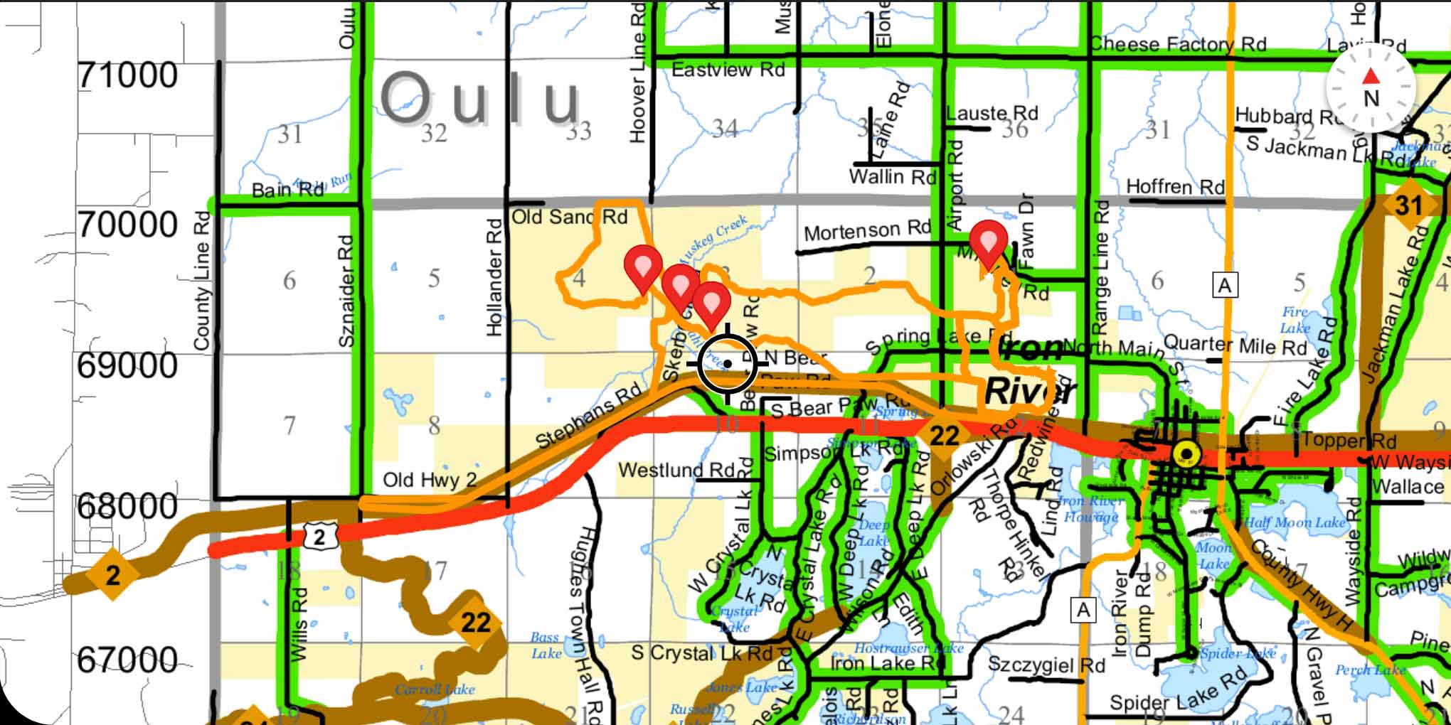
 Pan around the map to locate the town of Iron River.
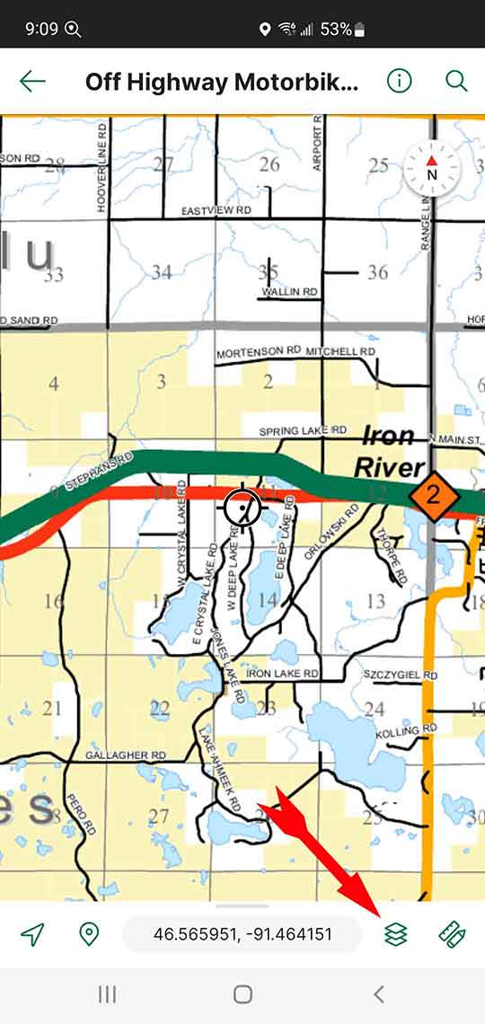
Tap on the “Map Layers” icon at the bottom of the screen.
Step 6
![]() It will show that your library is empty. Within the Map Layers screen, tap on the layers icon (yours may look different) to “Import Layers.”
It will show that your library is empty. Within the Map Layers screen, tap on the layers icon (yours may look different) to “Import Layers.”
Step 7
![]() Depending on where you saved the *.klm file, now select that location to start the import process and then select the saved NPSDR Trails.klm file.
Depending on where you saved the *.klm file, now select that location to start the import process and then select the saved NPSDR Trails.klm file.
Step 8
![]() Once the import is completed, you will now have the gps referenced NPSDR trails on your phone. At the top of the screen, tap on the “Back Arrow.”
Once the import is completed, you will now have the gps referenced NPSDR trails on your phone. At the top of the screen, tap on the “Back Arrow.”
Tap on the “Location” icon (bottom left) to jump to your current position. Assuming you are now located within the map field, your exact position on the map will be represented by a blue dot.
>> FYI: The Avenza Maps App has hundreds of available maps to download for any specific area. Like most mapping programs, you can save place-marks and utilize the tracking functions to save your own tracks.
>> Follow the link provided for more detailed help to better utilize all the features of Avenza Maps, [here].